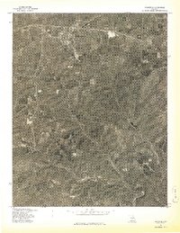
1977 Map of Mansfield
USGS Topo · Published 1977About this map
Mansfield serves as the primary focal point of this orthophoto study, which utilizes 1977 aerial imagery to document the Wright County landscape. The settlement's grid is clearly visible in the northern portion of the map, providing a baseline for the region's mid-century development. Moving south, the terrain transitions into the winding drainage of Bryant Creek, which meanders across the lower half of the sheet. This advance print offers a rare visual record of land use and vegetation patterns during the late 1970s, showcasing the cleared agricultural fields and dense woodlots that define this part of the Missouri Ozarks. Unlike traditional topographic maps, this orthophotograph allows for a direct visual inspection of specific farmsteads and rural road alignments as they existed on April 6, 1977.
Find a feature on this map
2 named features on this map. Tap any name to fly to it.
Don’t see what you’re looking for? This feature index may not catch every label — zoom into the map to look around manually.
Map Details
Editions of this 1977 Mansfield Map
This is the sole edition of this map. No revisions or reprints were ever made.
Other maps of this area

1936 · Ava
USGS Topo · 1:48,000

1937 · Buckhart
USGS Topo · 1:48,000

1942 · Ava
USGS Topo · 1:62,500

1943 · Buckhart
USGS Topo · 1:62,500

1945 · Ava
USGS Topo · 1:62,500

1945 · Harrison
USGS Topo · 1:250,000

1945 · Buckhart
USGS Topo · 1:62,500

1949 · Harrison
USGS Topo · 1:250,000

1951 · Norwood
USGS Topo · 1:24,000

1951 · Owens
USGS Topo · 1:24,000