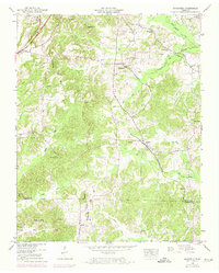
1950 Map of Mansfield
USGS Topo · Published 1974About this map
Mansfield and the surrounding rural communities of Henry County are defined by the winding waters of West Sandy Creek and the Tennessee Valley Divide. This mid-century landscape is heavily dotted with family burial grounds and country churches, reflecting a deeply rooted agricultural society. Settlements like Van Dyke and Routon are situated along the Louisville and Nashville railroad line, which served as a critical transport corridor for the region's produce and timber.
Find a feature on this map
50 named features on this map. Tap any name to fly to it.
Don’t see what you’re looking for? This feature index may not catch every label — zoom into the map to look around manually.
Map Details
Editions of this 1950 Mansfield Map
3 editions found

Other maps of this area

1936 · Mansfield
USGS Topo · 1:24,000

1936 · Vale
USGS Topo · 1:24,000

1936 · Bruceton
USGS Topo · 1:24,000

1936 · Manleyville
USGS Topo · 1:24,000

1936 · Paris
USGS Topo · 1:24,000

1936 · Springville
USGS Topo · 1:24,000

1938 · Springville
USGS Topo · 1:24,000

1940 · Manleyville
USGS Topo · 1:24,000

1941 · Manleyville
USGS Topo · 1:24,000

1950 · Osage
USGS Topo · 1:24,000