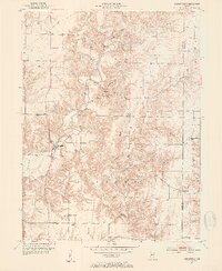
1951 Map of Mansfield
USGS Topo · Published 1953About this map
Raccoon Creek and its many winding tributaries define the topography of this rural Indiana landscape at the start of the 1950s. The settlement of Mansfield serves as a local hub near the Gaging Sta, while the surrounding townships of Union and Jackson are dotted with small communities like Ferndale, Vivalia, and Keytsville. The map reveals a dense network of country churches and family burial grounds, such as Farmers Chapel, Otterbein Ch, and the Miller Cem, which provide essential touchpoints for genealogical research.
Find a feature on this map
28 named features on this map. Tap any name to fly to it.
Don’t see what you’re looking for? This feature index may not catch every label — zoom into the map to look around manually.
Map Details
Editions of this 1951 Mansfield Map
2 editions found
Other maps of this area

1950 · Brazil East
USGS Topo · 1:24,000

1950 · Brazil West
USGS Topo · 1:24,000

1951 · Clinton Falls
USGS Topo · 1:24,000

1951 · Mansfield
USGS Topo · 1:24,000

1952 · Catlin
USGS Topo · 1:24,000

1952 · Reelsville
USGS Topo · 1:24,000

1953 · Indianapolis
USGS Topo · 1:250,000

1955 · Rockville
USGS Topo · 1:24,000

1955 · Russellville
USGS Topo · 1:24,000

1956 · Indianapolis
USGS Topo · 1:250,000