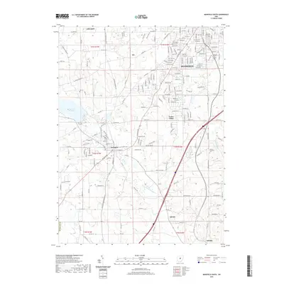
2019 Map of Mansfield South
USGS Topo · Published 2019About this map
Lexington and Bellville anchor the southern reaches of the Mansfield area, where the suburban residential grid begins to give way to the winding paths of the Clear Fork-Mohican River. The landscape is defined by its water features, notably the sprawling Clear Fork Reservoir to the west and the smaller Lake Maria further east. For researchers, this 2019 survey provides a precise look at local heritage through its numerous burial grounds, including the Day Cem and Troy Cem, as well as the German Evangelical Cem located near Possum Run. The map tracks the evolution of the region's transport network, from the dense streets of Mansfield and Ontario down through the smaller community of Hanley Village. It illustrates a transition from the structured urban township boundaries of t21n r18w and t21n r19w into the more open terrain of southern Richland County.
Find a feature on this map
80 named features on this map. Tap any name to fly to it.
Don’t see what you’re looking for? This feature index may not catch every label — zoom into the map to look around manually.
Map Details
Editions of this 2019 Mansfield South Map
This is the sole edition of this map. No revisions or reprints were ever made.
Other maps of this area

1908 · Ashland
USGS Topo · 1:62,500

1912 · Perrysville
USGS Topo · 1:62,500

1915 · Crestline
USGS Topo · 1:62,500

1915 · Perrysville
USGS Topo · 1:62,500

1915 · Shauck
USGS Topo · 1:62,500

1943 · Shauck
USGS Topo · 1:62,500

1943 · Crestline
USGS Topo · 1:62,500

1944 · Perrysville
USGS Topo · 1:62,500

1950 · Marion
USGS Topo · 1:250,000

1960 · Pavonia
USGS Topo · 1:24,000