
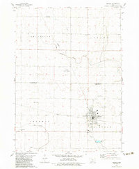
1979 Map of Manson
USGS Topo · Published 1979About this map
Manson serves as the primary hub of this late-1970s landscape, positioned at the intersection of the Illinois Central Gulf railroad and local thoroughfares. The town's layout includes a fairground, Rose Hill Cem, and local infrastructure such as Sew Disp Ponds and a Landing Strip. The surrounding rural expanse of Calhoun Co and Pocahontas Co is characterized by a high concentration of memorial sites, including the St Paul Cem, Swedish Cem, and Memorial Park Cem, reflecting the deep-rooted settlement history of the area.
Find a feature on this map
25 named features on this map. Tap any name to fly to it.
Don’t see what you’re looking for? This feature index may not catch every label — zoom into the map to look around manually.
Map Details
Editions of this 1979 Manson Map
2 editions found
Other maps of this area

1954 · Fort Dodge
USGS Topo · 1:250,000

1957 · Fort Dodge
USGS Topo · 1:250,000

1958 · Fort Dodge
USGS Topo · 1:250,000

1965 · Knierim
USGS Topo · 1:24,000

1979 · Pocahontas
USGS Topo · 1:24,000

1979 · Gilmore City SW
USGS Topo · 1:24,000

1979 · Pomeroy
USGS Topo · 1:24,000

1979 · Gilmore City
USGS Topo · 1:24,000

1979 · Palmer
USGS Topo · 1:24,000

1980 · Rockwell City
USGS Topo · 1:24,000