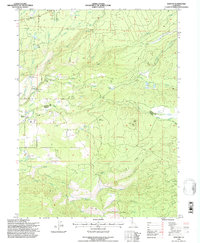
1995 Map of Manton
USGS Topo · Published 1997About this map
The Shasta Co Tehama Co line runs through this landscape where the high plateau meets the complex drainage systems of the North Fork Battle Creek and South Fork Battle Creek. The settlement of Manton serves as the focal point, situated near a network of water management features including the Union Canal, Keswick Ditch, and several aqueducts. This infrastructure supports local power generation at the Volta Powerhouse and another Power House further south along the canyon. The map reveals a land utilized for both utility and community, marked by the Sierra School, a local Cem, and the Manton Fire Station. Dominating the central terrain is Digger Butte, topped by the Lookout Digger, providing a vantage point over the timbered slopes and features like The Burn and Long Hay Flat.
Find a feature on this map
55 named features on this map. Tap any name to fly to it.
Don’t see what you’re looking for? This feature index may not catch every label — zoom into the map to look around manually.
Map Details
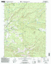
Editions of this 1995 Manton Map
2 editions found
Other maps of this area

1886 · Lassen Peak
USGS Topo · 1:250,000

1892 · Lassen Peak
USGS Topo · 1:250,000

1894 · Lassen Peak
USGS Topo · 1:250,000

1935 · Burney
USGS Topo · 1:96,000

1935 · Paynes Creek
USGS Topo · 1:96,000

1939 · Burney
USGS Topo · 1:125,000

1941 · Mineral
USGS Topo · 1:125,000

1955 · Westwood
USGS Topo · 1:250,000

1956 · Lassen Peak
USGS Topo · 1:62,500

1956 · Manton
USGS Topo · 1:62,500