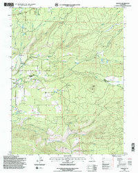
1995 Map of Manton
USGS Topo · Published 1997About this map
Manton sits at the heart of a landscape defined by an intricate network of water management features, where the Cross Country Flume and the Union Canal traverse the terrain alongside natural drainage like Digger Creek. This 1990s record of the Shasta and Tehama County border region highlights a complex hydroelectric and agricultural infrastructure, including the Volta Powerhouse, a Substation, and numerous penstocks and aqueducts. Local social history is anchored by the Sierra School and the town Cem, while the higher elevations are marked by the Lookout Digger atop Digger Butte. The prevalence of small reservoirs like Grace Lake and Nora Lake suggests a long history of diverted water powering the development of this volcanic plateau. Local genealogy is furthered by several named flats and gulches, such as Bailey Flat and Initial Gulch, which provide clues to early land use and settlement patterns.
Find a feature on this map
51 named features on this map. Tap any name to fly to it.
Don’t see what you’re looking for? This feature index may not catch every label — zoom into the map to look around manually.
Map Details
Editions of this 1995 Manton Map
2 editions found
Other maps of this area

1886 · Lassen Peak
USGS Topo · 1:250,000

1892 · Lassen Peak
USGS Topo · 1:250,000

1894 · Lassen Peak
USGS Topo · 1:250,000

1935 · Burney
USGS Topo · 1:96,000

1935 · Paynes Creek
USGS Topo · 1:96,000

1939 · Burney
USGS Topo · 1:125,000

1941 · Mineral
USGS Topo · 1:125,000

1955 · Westwood
USGS Topo · 1:250,000

1956 · Lassen Peak
USGS Topo · 1:62,500

1956 · Manton
USGS Topo · 1:62,500