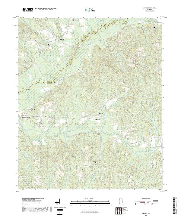
2024 Map of Mantua
USGS Topo · Published 2024About this map
The Sipsey River meanders across the border of Greene and Pickens counties, defining the northern landscape of this west Alabama region. Small, long-standing communities like Mantua, Benevola, and Union are connected by a network of rural roads such as M L King Hwy and Joseph Wilder Rd. The settlement pattern is deeply rooted in local history, evidenced by a high density of rural burial grounds including Sixteenth Section Cem, Mantua Cem, and the Bethesda Yard Cem near Bethesda Church. The terrain is shaped by numerous watercourses including Brush Creek, Little Creek, and Carpenters Creek, which cut through the land between quiet hamlets like Morrows Grove and Snoddy. This survey provides a contemporary record of these established family and community landmarks, essential for genealogists tracing local lineages.
Find a feature on this map
55 named features on this map. Tap any name to fly to it.
Don’t see what you’re looking for? This feature index may not catch every label — zoom into the map to look around manually.
Map Details
Editions of this 2024 Mantua Map
This is the sole edition of this map. No revisions or reprints were ever made.
Other maps of this area

1927 · Eutaw
USGS Topo · 1:48,000

1931 · Eutaw
USGS Topo · 1:62,500

1953 · Montgomery
USGS Topo · 1:250,000

1953 · Birmingham
USGS Topo · 1:250,000

1953 · Meridian
USGS Topo · 1:250,000

1953 · West Point
USGS Topo · 1:250,000

1956 · Birmingham
USGS Topo · 1:250,000

1956 · Montgomery
USGS Topo · 1:250,000

1957 · Birmingham
USGS Topo · 1:250,000

1957 · Meridian
USGS Topo · 1:250,000