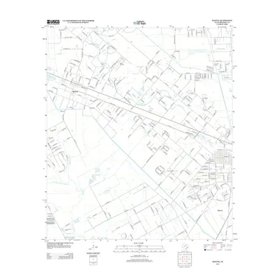
2013 Map of Manvel
USGS Topo · Published 2013About this map
Manvel and its surrounding coastal prairie landscape are defined by a complex network of waterways and early aviation infrastructure. The terrain is bifurcated by the winding paths of Mustang Bayou and Chocolate Bayou, which provide natural drainage alongside the engineered Briscoe Canal. Local history is anchored by sites like Manvel Cem and Booth Cem, marking the heritage of early settlers in this Brazoria County region. The presence of both Wolfe Air Park and Alvin Airpark indicates the area's significance for private aviation and small-scale transport during this period of development.
Find a feature on this map
261 named features on this map. Tap any name to fly to it.
Don’t see what you’re looking for? This feature index may not catch every label — zoom into the map to look around manually.
Map Details
Editions of this 2013 Manvel Map
This is the sole edition of this map. No revisions or reprints were ever made.
Other maps of this area

1916 · Genoa
USGS Topo · 1:24,000

1920 · Genoa
USGS Topo · 1:31,680

1920 · Mykawa
USGS Topo · 1:31,680

1920 · Almeda
USGS Topo · 1:31,680

1929 · Algoa
USGS Topo · 1:24,000

1932 · Algoa
USGS Topo · 1:31,680
1932 · Genoa
USGS Topo · 1:31,680

1932 · Mustang Bayou
USGS Topo · 1:31,680

1943 · Rosharon
USGS Topo · 1:31,680

1943 · Mustang Bayou
USGS Topo · 1:31,680