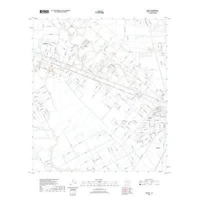
2019 Map of Manvel
USGS Topo · Published 2019About this map
Mustang Bayou and Chocolate Bayou wind through this coastal prairie landscape, illustrating the intricate drainage patterns south of Houston before they reach the Gulf. The residential expansion of Alvin and Manvel is evident in the dense street grids that contrast with the more open acreage to the west. Local landmarks like Manvel Cem and Booth Cem offer specific points of interest for genealogists tracing family histories in Brazoria County. This 2019 survey also documents the aviation history of the region, featuring both Wolfe Air Park and Alvin Airpark. The presence of the Briscoe Canal further highlights the managed water systems essential to this region's agriculture and drainage. From the established neighborhoods of Hillcrest to the evolving rural roads, the map provides a clear view of the area's transition into a modern suburban corridor.
Find a feature on this map
202 named features on this map. Tap any name to fly to it.
Don’t see what you’re looking for? This feature index may not catch every label — zoom into the map to look around manually.
Map Details
Editions of this 2019 Manvel Map
This is the sole edition of this map. No revisions or reprints were ever made.
Other maps of this area

1916 · Genoa
USGS Topo · 1:24,000

1920 · Genoa
USGS Topo · 1:31,680

1920 · Mykawa
USGS Topo · 1:31,680

1920 · Almeda
USGS Topo · 1:31,680

1929 · Algoa
USGS Topo · 1:24,000

1932 · Algoa
USGS Topo · 1:31,680
1932 · Genoa
USGS Topo · 1:31,680

1932 · Mustang Bayou
USGS Topo · 1:31,680

1943 · Rosharon
USGS Topo · 1:31,680

1943 · Mustang Bayou
USGS Topo · 1:31,680