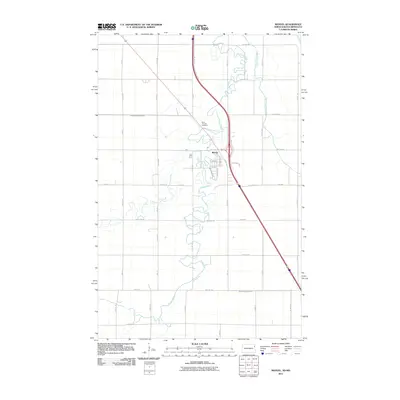
2011 Map of Manvel
USGS Topo · Published 2011About this map
Manvel serves as the central hub of this North Dakota landscape, where the town's residential street grid is nestled within a sharp bend of the Turtle River. The meandering river and its northern counterpart, the South Marais River, dominate the eastern half of the map, carving winding paths through the flat Red River Valley terrain. Human engineering is evident in the straight lines of the extensive local road network and significant drainage projects like County Ditch Number 32 and County Ditch Number 11, which are critical for managing the region's agricultural productivity. For those researching local heritage, the Saint Timothy Cemetery stands just north of the town center near the riverbanks. The town itself shows clear organization with named thoroughfares such as Western Avenue and Copeland Avenue, reflecting the modern layout of this rural community in the early 21st century.
Find a feature on this map
40 named features on this map. Tap any name to fly to it.
Don’t see what you’re looking for? This feature index may not catch every label — zoom into the map to look around manually.
Map Details
Editions of this 2011 Manvel Map
This is the sole edition of this map. No revisions or reprints were ever made.
Other maps of this area

1926 · Ardoch
USGS Topo · 1:62,500

1934 · Emerado
USGS Topo · 1:48,000

1934 · Grand Forks
USGS Topo · 1:24,000

1934 · Grand Forks
USGS Topo · 1:62,500

1936 · Emerado
USGS Topo · 1:62,500

1938 · Grand Forks
USGS Topo · 1:62,500

1952 · Grand Forks
USGS Topo · 1:250,000

1952 · Thief River Falls
USGS Topo · 1:250,000

1956 · Thief River Falls
USGS Topo · 1:250,000

1956 · Grand Forks
USGS Topo · 1:250,000