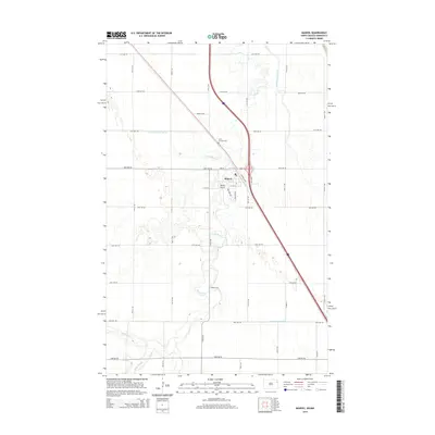
2014 Map of Manvel
USGS Topo · Published 2014About this map
Manvel serves as the central hub of this eastern North Dakota landscape, situated at a junction where the natural curves of the Turtle River meet a grid of rural avenues and state infrastructure. The township layout is defined by its agricultural utility, with the South Marais River and engineered waterways like County Ditch Number 32 and County Ditch Number 11 managing the low-lying terrain of the Red River Valley. Local history is anchored by the Saint Timothy Cem north of the main settlement, while the presence of Heyde Airport indicates the importance of local aviation in this sprawling prairie environment. To the southwest, the distinctive wetlands of Kelly Slough break the pattern of the fields, offering a look at the area's original hydrology amidst the modern road network of the 2010s.
Find a feature on this map
25 named features on this map. Tap any name to fly to it.
Don’t see what you’re looking for? This feature index may not catch every label — zoom into the map to look around manually.
Map Details
Editions of this 2014 Manvel Map
This is the sole edition of this map. No revisions or reprints were ever made.
Other maps of this area

1926 · Ardoch
USGS Topo · 1:62,500

1934 · Emerado
USGS Topo · 1:48,000

1934 · Grand Forks
USGS Topo · 1:24,000

1934 · Grand Forks
USGS Topo · 1:62,500

1936 · Emerado
USGS Topo · 1:62,500

1938 · Grand Forks
USGS Topo · 1:62,500

1952 · Grand Forks
USGS Topo · 1:250,000

1952 · Thief River Falls
USGS Topo · 1:250,000

1956 · Thief River Falls
USGS Topo · 1:250,000

1956 · Grand Forks
USGS Topo · 1:250,000