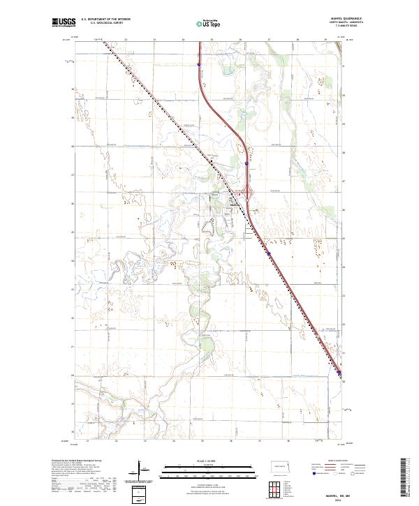
2024 Map of Manvel
USGS Topo · Published 2024About this map
The Turtle River meanders through the heart of this Grand Forks County landscape, defining the character of Manvel, North Dakota. This modern survey illustrates a community where residential streets like Western Ave and Oldham Ave meet the expansive agricultural grid of the Red River Valley. The town serves as a local hub, supported by infrastructure such as Heyde Airport and religious landmarks like Saint Timothy Cem. To the south, the terrain shifts into the managed wetlands of the Grand Forks County Waterfowl Production Area, where the river reaches Kelly Slough. The intricate network of waterways, including the South Marais River and significant drainage projects like County Ditch Number 32, highlights the ongoing efforts to manage this low-lying prairie environment for both conservation and cultivation.
Find a feature on this map
43 named features on this map. Tap any name to fly to it.
Don’t see what you’re looking for? This feature index may not catch every label — zoom into the map to look around manually.
Map Details
Editions of this 2024 Manvel Map
This is the sole edition of this map. No revisions or reprints were ever made.
Other maps of this area

1926 · Ardoch
USGS Topo · 1:62,500

1934 · Emerado
USGS Topo · 1:48,000

1934 · Grand Forks
USGS Topo · 1:24,000

1934 · Grand Forks
USGS Topo · 1:62,500

1936 · Emerado
USGS Topo · 1:62,500

1938 · Grand Forks
USGS Topo · 1:62,500

1952 · Grand Forks
USGS Topo · 1:250,000

1952 · Thief River Falls
USGS Topo · 1:250,000

1956 · Thief River Falls
USGS Topo · 1:250,000

1956 · Grand Forks
USGS Topo · 1:250,000