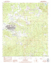
1988 Map of Many
USGS Topo · Published 1988About this map
Many, the seat of Sabine Parish, serves as the central hub of this late 1980s landscape, where urban development meets a dense network of creek systems. The map documents the town's layout alongside Hart Airport and the prominent Radio Tower, reflecting the region's mid-century infrastructure. To the northeast, the Fort Jesup State Commemorative Area preserves the site of the historic Fort Jesup, a critical military frontier post from the early 19th century.
Find a feature on this map
26 named features on this map. Tap any name to fly to it.
Don’t see what you’re looking for? This feature index may not catch every label — zoom into the map to look around manually.
Map Details
Editions of this 1988 Many Map
This is the sole edition of this map. No revisions or reprints were ever made.
Other maps of this area

1941 · Zwolle
USGS Topo · 1:62,500

1942 · Many
USGS Topo · 1:62,500

1942 · Florien
USGS Topo · 1:62,500

1943 · Many
USGS Topo · 1:62,500

1944 · Negreet
USGS Topo · 1:62,500

1944 · Florien
USGS Topo · 1:62,500

1944 · Zwolle
USGS Topo · 1:62,500

1953 · Alexandria
USGS Topo · 1:250,000

1954 · Florien
USGS Topo · 1:62,500
1954 · Florien
USGS Topo · 1:24,000