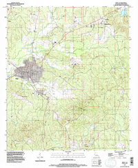
1994 Map of Many
USGS Topo · Published 1997About this map
Many serves as the focal point of this western Louisiana landscape, shown here as a structured grid of streets and municipal infrastructure during the mid-1990s. The town's significance as a regional hub is evident in its concentration of services, including several cemeteries, multiple communication towers, and the nearby Hart Airport. To the northeast, the Fort Jesup State Commemorative Area preserves the site of Fort Jesup, reflecting the area's deep-rooted frontier history.
Find a feature on this map
31 named features on this map. Tap any name to fly to it.
Don’t see what you’re looking for? This feature index may not catch every label — zoom into the map to look around manually.
Map Details
Editions of this 1994 Many Map
This is the sole edition of this map. No revisions or reprints were ever made.
Other maps of this area

1941 · Zwolle
USGS Topo · 1:62,500

1942 · Many
USGS Topo · 1:62,500

1942 · Florien
USGS Topo · 1:62,500

1943 · Many
USGS Topo · 1:62,500

1944 · Negreet
USGS Topo · 1:62,500

1944 · Florien
USGS Topo · 1:62,500

1944 · Zwolle
USGS Topo · 1:62,500

1953 · Alexandria
USGS Topo · 1:250,000

1954 · Florien
USGS Topo · 1:62,500
1954 · Florien
USGS Topo · 1:24,000