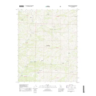
2018 Map of Manzanita Mountain
USGS Topo · Published 2018About this map
Manzanita Mtn rises above a labyrinth of drainage systems in this remote section of the Los Padres National Forest. The landscape is defined by the sharp transition between the Sierra Madre Mountains and an intricate network of canyons, including the curiously named Script Canyon Number One and Script Canyon Number Two. This 2018 survey reveals a terrain shaped by water and elevation, where seasonal flows like the S Fork La Brea Cr and N Fork La Brea Cr carve deep paths through the backcountry. A few vital access points, such as La Brea Canyon Rd and Pine Canyon Rd, navigate the ridges and canyon floors. Notable landmarks for navigation and survival in this arid environment include Horseshoe Spring and the prominent Buckhorn Ridge.
Find a feature on this map
34 named features on this map. Tap any name to fly to it.
Don’t see what you’re looking for? This feature index may not catch every label — zoom into the map to look around manually.
Map Details
Editions of this 2018 Manzanita Mountain Map
This is the sole edition of this map. No revisions or reprints were ever made.
Other maps of this area

1902 · Santa Ynez
USGS Topo · 1:125,000

1905 · Santa Ynez
USGS Topo · 1:125,000

1905 · Lompoc
USGS Topo · 1:125,000

1912 · McKittrick
USGS Topo · 1:125,000

1937 · Branch Mtn
USGS Topo · 1:48,000

1941 · Caliente Mountain
USGS Topo · 1:62,500

1941 · McPherson Peak
USGS Topo · 1:62,500

1942 · Lompoc
USGS Topo · 1:125,000

1942 · Branch Mountain
USGS Topo · 1:62,500

1942 · Caliente Mtn
USGS Topo · 1:62,500