2022 Map of Maple Hill
USGS Topo · Published 2022About this map
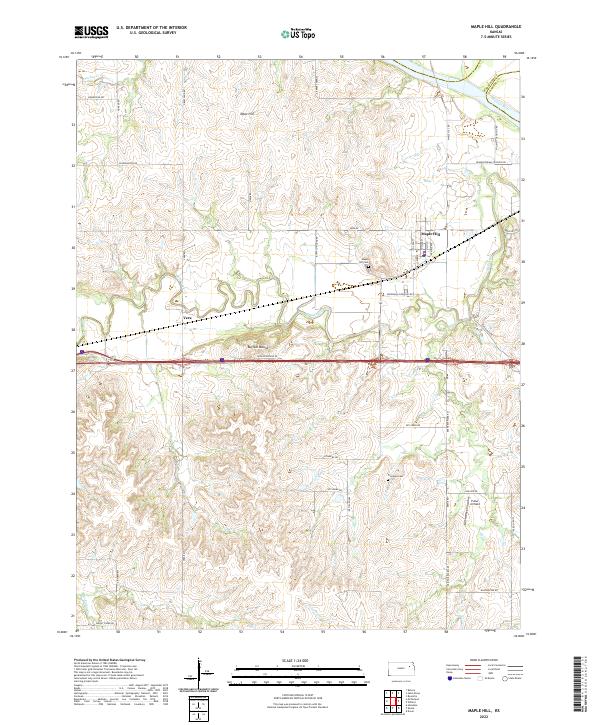
The Kansas River flows through the northeastern corner of this landscape in eastern Wabaunsee County, where the plains give way to a network of winding creek valleys. Maple Hill serves as the primary settlement, situated on the high ground north of Mill Creek. This modern survey documents a rural environment shaped by traditional ranching and farming, evidenced by roads like Cattleman Rd and Tod Ranch Rd. Prominent landmarks such as Tabor Hill and Buffalo Mound provide significant relief above the surrounding drainages of Turkey Creek and Snokomo Creek. For those researching family history, the map identifies local burial sites at Maple Hill Cemetery and the more isolated Freeman Cemetery. Transport patterns are defined by the Interstate 70 corridor cutting through the center, while local aviation is represented by Fuller Airfield in the southeast.
Find a feature on this map
48 named features on this map. Tap any name to fly to it.
Don’t see what you’re looking for? This feature index may not catch every label — zoom into the map to look around manually.
Map Details
Editions of this 2022 Maple Hill Map
This is the sole edition of this map. No revisions or reprints were ever made.