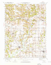
1941 Map of Maquon
USGS Topo · Published 1976About this map
The Spoon River and its many tributaries, including Sugar Creek and Court Creek, define the topography of southeast Knox County during the mid-twentieth century. This rural landscape is heavily marked by small-scale coal extraction, visible at the Strip Mine north of Dahinda and the Knoxville Mine near Appleton. The region is a dense network of early twentieth-century education, featuring dozens of named schoolhouses like Red Oak Sch, Stump Valley Sch, and Hazel Green Sch that served the farming townships of Sparta, Truro, and Elba.
Find a feature on this map
94 named features on this map. Tap any name to fly to it.
Don’t see what you’re looking for? This feature index may not catch every label — zoom into the map to look around manually.
Map Details
Editions of this 1941 Maquon Map
2 editions found
Other maps of this area

1912 · Canton
USGS Topo · 1:62,500

1915 · Avon
USGS Topo · 1:62,500

1925 · Galesburg
USGS Topo · 1:62,500

1927 · Galesburg
USGS Topo · 1:62,500

1930 · Glasford
USGS Topo · 1:62,500

1931 · Galva
USGS Topo · 1:48,000

1940 · Galva
USGS Topo · 1:62,500

1941 · Maquon
USGS Topo · 1:62,500

1943 · Maquon
USGS Topo · 1:62,500

1944 · Galva
USGS Topo · 1:62,500