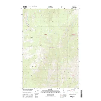
2017 Map of Marble Butte
USGS Topo · Published 2017About this map
The high backcountry of Nez Perce National Forest dominates this topographic study, characterized by a network of peaks and high-elevation basins. Significant landmarks include Marble Butte and Square Mtn, which provide vertical context for the surrounding meadows and water sources. Square Mountain Lake and Twin Lakes sit in the northern reaches, while Sweet Anise Spring and Anchor Meadow offer more localized points of interest for those tracking historical land use or natural features in Idaho County.
Find a feature on this map
42 named features on this map. Tap any name to fly to it.
Don’t see what you’re looking for? This feature index may not catch every label — zoom into the map to look around manually.
Map Details
Editions of this 2017 Marble Butte Map
This is the sole edition of this map. No revisions or reprints were ever made.
Other maps of this area

1931 · Buffalo Hump
USGS Topo · 1:125,000

1934 · Buffalo Hump
USGS Topo · 1:125,000

1956 · Burgdorf
USGS Topo · 1:62,500

1956 · Warren
USGS Topo · 1:62,500

1956 · Elk City
USGS Topo · 1:250,000

1960 · Elk City
USGS Topo · 1:250,000

1963 · Sourdough Peak
USGS Topo · 1:24,000

1963 · Hanover Mtn.
USGS Topo · 1:24,000

1963 · Marble Butte
USGS Topo · 1:24,000
1963 · Sawyer Ridge
USGS Topo · 1:24,000