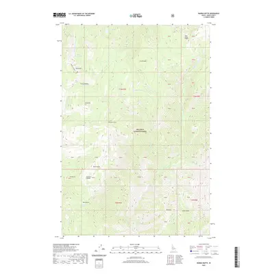
2020 Map of Marble Butte
USGS Topo · Published 2020About this map
Nez Perce National Forest dominates this landscape in Idaho County, revealing a high-elevation backcountry defined by peaks and glacial basins. The terrain is anchored by prominent elevations such as Marble Butte, Sheep Mtn, and Square Mtn. These summits rise above significant meadowlands and alpine water bodies, including Long Meadow, Anchor Meadow, and the basin holding Square Mountain Lake.
Find a feature on this map
49 named features on this map. Tap any name to fly to it.
Don’t see what you’re looking for? This feature index may not catch every label — zoom into the map to look around manually.
Map Details
Editions of this 2020 Marble Butte Map
This is the sole edition of this map. No revisions or reprints were ever made.
Other maps of this area

1931 · Buffalo Hump
USGS Topo · 1:125,000

1934 · Buffalo Hump
USGS Topo · 1:125,000

1956 · Burgdorf
USGS Topo · 1:62,500

1956 · Warren
USGS Topo · 1:62,500

1956 · Elk City
USGS Topo · 1:250,000

1960 · Elk City
USGS Topo · 1:250,000

1963 · Sourdough Peak
USGS Topo · 1:24,000

1963 · Hanover Mtn.
USGS Topo · 1:24,000

1963 · Marble Butte
USGS Topo · 1:24,000
1963 · Sawyer Ridge
USGS Topo · 1:24,000