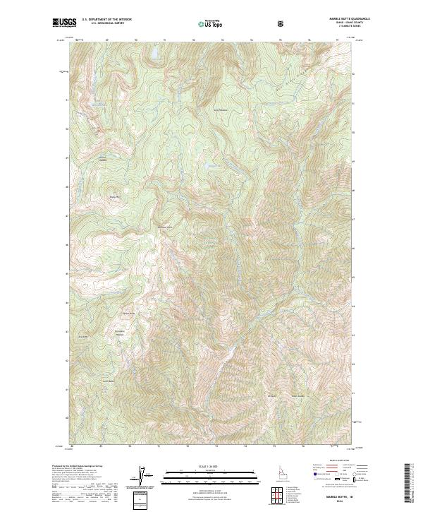
2024 Map of Marble Butte
USGS Topo · Published 2024About this map
Nez Perce National Forest and the Gospel-Hump Wilderness dominate this high-altitude terrain in central Idaho, where drainage systems from several distinct peaks converge. The landscape is defined by massive formations such as Marble Butte, Elk Butte, and Square Mtn, with Bear Grass Ridge cutting across the northern reaches. Water is abundant throughout these heights, ranging from the concentrated waters of Square Mountain Lake and Hidden Lake to the headwaters of Sheep Creek and Arizona Creek. Small pockets of level ground provide landmarks for navigation and historic use, including Long Meadow, Anchor Meadow, and Porcupine Meadow. To the south, Sweet Anise Spring sits near North Butte, while the Moores Station Rd provides one of the few named access routes through this steep, remote interior. This map records the drainage patterns and land boundaries within the federally protected wilderness as they were documented in the 2024 update.
Find a feature on this map
50 named features on this map. Tap any name to fly to it.
Don’t see what you’re looking for? This feature index may not catch every label — zoom into the map to look around manually.
Map Details
Editions of this 2024 Marble Butte Map
This is the sole edition of this map. No revisions or reprints were ever made.
Other maps of this area

1931 · Buffalo Hump
USGS Topo · 1:125,000

1934 · Buffalo Hump
USGS Topo · 1:125,000

1956 · Burgdorf
USGS Topo · 1:62,500

1956 · Warren
USGS Topo · 1:62,500

1956 · Elk City
USGS Topo · 1:250,000

1960 · Elk City
USGS Topo · 1:250,000

1963 · Sourdough Peak
USGS Topo · 1:24,000

1963 · Hanover Mtn.
USGS Topo · 1:24,000

1963 · Marble Butte
USGS Topo · 1:24,000
1963 · Sawyer Ridge
USGS Topo · 1:24,000