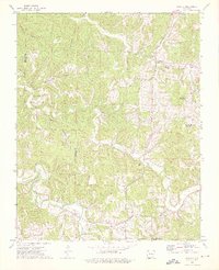
1973 Map of Marble
USGS Topo · Published 1976About this map
Marble sits at the confluence of the Kings River and Onion Creek in this 1970s study of the Ozark highlands spanning the boundary of Carroll and Madison counties. The settlement pattern follows the intricate drainage systems of the White River basin, with small communities and family burial grounds located near water sources and along the valley floors. Metalton occupies a northern bend of Piney Creek, while several rural cemeteries like White Oak Cem, Meri Cem, and Lower Cem are tucked into the drainages of White Oak Creek and Dry Fork.
Find a feature on this map
23 named features on this map. Tap any name to fly to it.
Don’t see what you’re looking for? This feature index may not catch every label — zoom into the map to look around manually.
Map Details
Editions of this 1973 Marble Map
2 editions found
Other maps of this area

1900 · Eureka Springs
USGS Topo · 1:125,000

1901 · Eureka Springs
USGS Topo · 1:125,000

1904 · Harrison
USGS Topo · 1:125,000

1905 · Harrison
USGS Topo · 1:125,000

1945 · Harrison
USGS Topo · 1:250,000

1949 · Harrison
USGS Topo · 1:250,000

1954 · Harrison
USGS Topo · 1:250,000

1958 · Harrison
USGS Topo · 1:250,000

1964 · Harrison
USGS Topo · 1:250,000
1968 · Osage
USGS Topo · 1:24,000