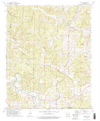
1973 Map of Marble
USGS Topo · Published 1976About this map
The Kings River snakes through the southern reaches of this Ozark landscape, providing a primary drainage point for the surrounding hollows and ridges. Near its banks sits the settlement of Marble, while the community of Metalton occupies the northern terrain. The map documents a scattered social geography of upland life, marked by small country churches like White Oak Ch and Lower Campground Ch, alongside numerous family burial grounds including White Oak Cem, Marble Cem, and Meri Cem.
Find a feature on this map
25 named features on this map. Tap any name to fly to it.
Don’t see what you’re looking for? This feature index may not catch every label — zoom into the map to look around manually.
Map Details
Editions of this 1973 Marble Map
2 editions found
Other maps of this area

1900 · Eureka Springs
USGS Topo · 1:125,000

1901 · Eureka Springs
USGS Topo · 1:125,000

1904 · Harrison
USGS Topo · 1:125,000

1905 · Harrison
USGS Topo · 1:125,000

1945 · Harrison
USGS Topo · 1:250,000

1949 · Harrison
USGS Topo · 1:250,000

1954 · Harrison
USGS Topo · 1:250,000

1958 · Harrison
USGS Topo · 1:250,000

1964 · Harrison
USGS Topo · 1:250,000
1968 · Osage
USGS Topo · 1:24,000