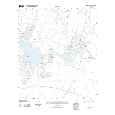
2010 Map of Marble Falls
USGS Topo · Published 2010About this map
Marble Falls sits at the heart of a complex water management landscape, where the Colorado River is partitioned by significant engineering projects. The proximity of the Alvin Wirtz Dam and the Max Starcke Dam creates a chain of reservoirs including Lake Lyndon B Johnson, Lake Marble Falls, and the headwaters of Lake Travis. These controlled waters define the residential patterns of the area, supporting established communities like Meadowlakes, Cottonwood Shores, and the expansive developments at Horseshoe Bay.
Find a feature on this map
76 named features on this map. Tap any name to fly to it.
Don’t see what you’re looking for? This feature index may not catch every label — zoom into the map to look around manually.
Map Details
Editions of this 2010 Marble Falls Map
This is the sole edition of this map. No revisions or reprints were ever made.
Other maps of this area

1887 · Blanco
USGS Topo · 1:125,000

1887 · Burnet
USGS Topo · 1:125,000

1893 · Burnet
USGS Topo · 1:125,000

1894 · Blanco
USGS Topo · 1:125,000

1903 · Burnet
USGS Topo · 1:125,000

1909 · Burnet
USGS Topo · 1:125,000

1925 · Burnet 3-b
USGS Topo · 1:48,000

1925 · Burnet 3-d
USGS Topo · 1:48,000

1929 · Marble Falls
USGS Topo · 1:62,500

1931 · Marble Falls
USGS Topo · 1:48,000