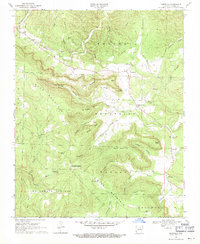
1969 Map of Marcella
USGS Topo · Published 1971About this map
The Ozark foothills of Stone County are defined by a series of steep ridges and spring-fed hollows, centered around the settlement of St James and the community of Pleasant Grove. This late 1960s survey captures the rural landscape where State Route 14 winds through the hills past Davis Mountain and Blue Mountain. The map shows a clear cultural imprint through its several country churches, including Dugan Ch, Arbanna Ch, and a Mennonite Ch, alongside family-named burial grounds like the Kelly and Ford Cem.
Find a feature on this map
56 named features on this map. Tap any name to fly to it.
Don’t see what you’re looking for? This feature index may not catch every label — zoom into the map to look around manually.
Map Details
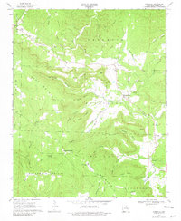
Editions of this 1969 Marcella Map
2 editions found
Other maps of this area

1890 · Batesville
USGS Topo · 1:125,000

1891 · Batesville
USGS Topo · 1:125,000

1892 · Mountain View
USGS Topo · 1:125,000

1894 · Mountain View
USGS Topo · 1:125,000

1942 · Bethesda
USGS Topo · 1:24,000

1942 · Almond
USGS Topo · 1:31,680

1942 · Mt Pleasant
USGS Topo · 1:31,680

1953 · Memphis
USGS Topo · 1:250,000

1956 · Memphis
USGS Topo · 1:250,000

1956 · Russellville
USGS Topo · 1:250,000