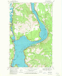
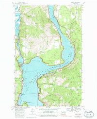
1969 Map of Marcus
USGS Topo · Published 1972About this map
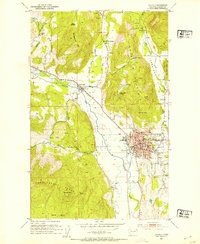
The Columbia River and Franklin D Roosevelt Lake dominate this Stevens County landscape, revealing the complex geography of the Roosevelt Lake National Recreation Area during the late 1960s. The town of Marcus sits near the confluence of the Columbia and the Kettle River, serving as a focal point for local industry and transport. Evidence of the region's extractive economy is visible through the Burlington Northern railroad lines that serve local operations like the Napoleon Mine, Kifer Quarry, and the Dipper Mine.
Find a feature on this map
57 named features on this map. Tap any name to fly to it.
Don’t see what you’re looking for? This feature index may not catch every label — zoom into the map to look around manually.
Map Details
Editions of this 1969 Marcus Map
2 editions found
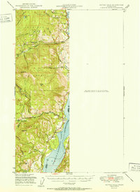
Other maps of this area

1929 · Colville
USGS Topo · 1:125,000

1933 · Colville
USGS Topo · 1:125,000

1936 · Marcus
USGS Topo · 1:96,000

1942 · Marcus
USGS Topo · 1:125,000

1948 · Kettle Falls
USGS Topo · 1:62,500

1948 · Orient
USGS Topo · 1:62,500

1951 · Orient
USGS Topo · 1:62,500
1951 · Kettle Falls
USGS Topo · 1:62,500
1952 · Echo Valley
USGS Topo · 1:24,000
1952 · Colville
USGS Topo · 1:24,000