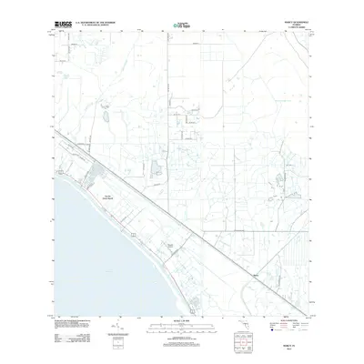
2012 Map of Marcy
USGS Topo · Published 2012About this map
Lake Okeechobee defines the southwestern edge of this survey, where the water meets a landscape deeply shaped by drainage and citrus agriculture. The settlement of Marcy sits at a strategic junction near the eastern shore, connected by the long-established SW Martin Hwy. Further north along the shoreline, the community at Up the Grove Beach occupies the narrow strip between the lake and the interior marshlands. The hydrology of the region is dominated by channelized waterways like Nubbin Slough, Henry Cr, and Lettuce Cr, which are essential to the agricultural management of the Florida interior. Local transit and private aviation are evidenced by the presence of Baggett Airpark, while family-named roads such as Murphy White Rd suggest the enduring presence of local landholders in this Martin County corridor.
Find a feature on this map
34 named features on this map. Tap any name to fly to it.
Don’t see what you’re looking for? This feature index may not catch every label — zoom into the map to look around manually.
Map Details
Editions of this 2012 Marcy Map
This is the sole edition of this map. No revisions or reprints were ever made.
Other maps of this area

1952 · Okeechobee
USGS Topo · 1:24,000

1953 · Okeechobee 4 SW
USGS Topo · 1:24,000

1953 · Okeechobee 4 SE
USGS Topo · 1:24,000

1953 · Okeechobee 1 SE
USGS Topo · 1:24,000

1953 · Okeechobee 4 NE
USGS Topo · 1:24,000

1953 · Okeechobee 4 NW
USGS Topo · 1:24,000

1953 · Okeechobee 1 SW
USGS Topo · 1:24,000

1953 · Taylor Creek SE
USGS Topo · 1:24,000

1956 · Fort Pierce
USGS Topo · 1:250,000

1958 · Fort Pierce
USGS Topo · 1:250,000