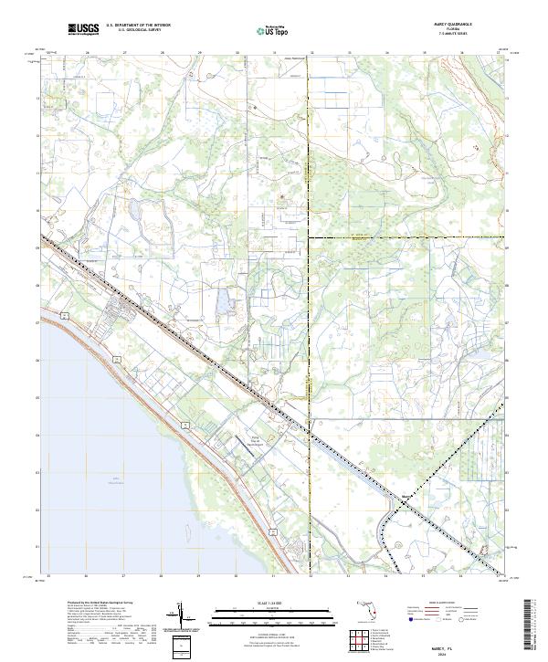
2024 Map of Marcy
USGS Topo · Published 2024About this map
Lake Okeechobee dominates the southwestern corner of this coastal-plain landscape, where the shoreline meets a complex network of man-made and natural water systems. The settlement of Marcy sits near the junction of several critical drainage features, including Henry Creek and Lettuce Creek, reflecting the region's managed hydrology and agricultural layout. The terrain transitions from the open water and levee systems into more interior features like Jones Hammock and the winding course of Van Swearingen Creek.
Find a feature on this map
47 named features on this map. Tap any name to fly to it.
Don’t see what you’re looking for? This feature index may not catch every label — zoom into the map to look around manually.
Map Details
Editions of this 2024 Marcy Map
This is the sole edition of this map. No revisions or reprints were ever made.
Other maps of this area

1952 · Okeechobee
USGS Topo · 1:24,000

1953 · Okeechobee 4 SW
USGS Topo · 1:24,000

1953 · Okeechobee 4 SE
USGS Topo · 1:24,000

1953 · Okeechobee 1 SE
USGS Topo · 1:24,000

1953 · Okeechobee 4 NE
USGS Topo · 1:24,000

1953 · Okeechobee 4 NW
USGS Topo · 1:24,000

1953 · Okeechobee 1 SW
USGS Topo · 1:24,000

1953 · Taylor Creek SE
USGS Topo · 1:24,000

1956 · Fort Pierce
USGS Topo · 1:250,000

1958 · Fort Pierce
USGS Topo · 1:250,000