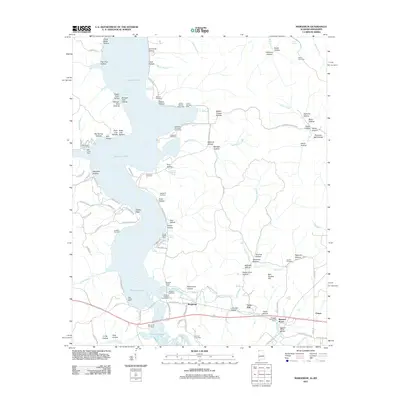
2011 Map of Margerum
USGS Topo · Published 2011About this map
Pickwick Lake dominates the landscape where the Tennessee River borders northwestern Alabama and Mississippi, its waters filling former creek channels and surrounding prominent landforms like the Buchanan Peninsula. The settlement of Margerum sits at a crossroads of the rail and road network south of the lake, near the industrial site of a Lime Kiln. This 2011 survey captures a mix of longstanding rural landmarks and modern recreational access points, including the Buzzard Roost Dock and Mill Creek Dock.
Find a feature on this map
114 named features on this map. Tap any name to fly to it.
Don’t see what you’re looking for? This feature index may not catch every label — zoom into the map to look around manually.
Map Details
Editions of this 2011 Margerum Map
This is the sole edition of this map. No revisions or reprints were ever made.
Other maps of this area

1911 · Iuka
USGS Topo · 1:48,000

1914 · Iuka
USGS Topo · 1:62,500

1924 · Gravelly Springs
USGS Topo · 1:48,000

1925 · Barton
USGS Topo · 1:62,500

1926 · Barton
USGS Topo · 1:48,000

1926 · Gravelly Springs
USGS Topo · 1:62,500

1929 · Barton
USGS Topo · 1:62,500

1935 · Cherokee
USGS Topo · 1:24,000

1935 · Wright
USGS Topo · 1:24,000

1935 · Iuka
USGS Topo · 1:24,000