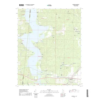
2018 Map of Margerum
USGS Topo · Published 2018About this map
The borderlands of Alabama and Mississippi intersect at the community of Margerum, where the industrial history of Colbert County is marked by the presence of a Lime Kiln and the Buzzard Roost Bridge. This modern topographic survey illustrates the enduring rural landscape where historic family holdings are still traced through numerous burial grounds like Canaan Cem, Douthit Cem, and Morris Hill Cem. The terrain is deeply etched with hollows named for early inhabitants and local landmarks, including Barnett Mill Hollow and Florence Mill Hollow. Transportation patterns here are defined by the intersection of local routes like the Riverton Rose Trl and the federally preserved Natchez Trace Parkway, which cuts through the southern portion of the quadrangle. From the waters of Goose Pond Slough to the upland site of Walker Chapel, the map details a region where traditional settlement patterns persist alongside managed parklands.
Find a feature on this map
112 named features on this map. Tap any name to fly to it.
Don’t see what you’re looking for? This feature index may not catch every label — zoom into the map to look around manually.
Map Details
Editions of this 2018 Margerum Map
This is the sole edition of this map. No revisions or reprints were ever made.
Other maps of this area

1911 · Iuka
USGS Topo · 1:48,000

1914 · Iuka
USGS Topo · 1:62,500

1924 · Gravelly Springs
USGS Topo · 1:48,000

1925 · Barton
USGS Topo · 1:62,500

1926 · Barton
USGS Topo · 1:48,000

1926 · Gravelly Springs
USGS Topo · 1:62,500

1929 · Barton
USGS Topo · 1:62,500

1935 · Cherokee
USGS Topo · 1:24,000

1935 · Wright
USGS Topo · 1:24,000

1935 · Iuka
USGS Topo · 1:24,000