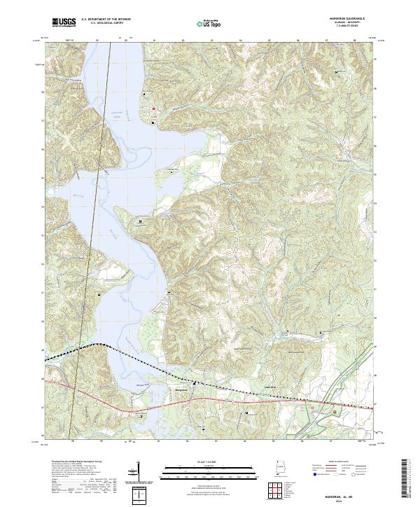
2024 Map of Margerum
USGS Topo · Published 2024About this map
Bear Creek flows through the borderlands of Alabama and Mississippi, carving a landscape defined by deep hollows and creek bottomlands in the western reaches of the Tennessee River valley. This 2024 data reflects a region where the modern Natchez Trace Parkway bisects a landscape long shaped by its proximity to the water and the state line. The settlement of Margerum sits near the crossing of Buzzard Roost Creek, surrounded by dozens of named topographic features like Chalk Mine Hollow and Fish Trap Hollow that point to early local industry and subsistence practices. Numerous family burial grounds, including the Caryton / Cockburn Cem and Crenshaw Cem, are preserved across the ridges, providing a clear map for genealogists tracing the legacy of the families who settled this corner of Colbert Co. The presence of landmarks like Fishtrap Ford and Spout Spring highlights the historical importance of natural water sources and river crossings in the area's development.
Find a feature on this map
115 named features on this map. Tap any name to fly to it.
Don’t see what you’re looking for? This feature index may not catch every label — zoom into the map to look around manually.
Map Details
Editions of this 2024 Margerum Map
This is the sole edition of this map. No revisions or reprints were ever made.
Other maps of this area

1911 · Iuka
USGS Topo · 1:48,000

1914 · Iuka
USGS Topo · 1:62,500

1924 · Gravelly Springs
USGS Topo · 1:48,000

1925 · Barton
USGS Topo · 1:62,500

1926 · Barton
USGS Topo · 1:48,000

1926 · Gravelly Springs
USGS Topo · 1:62,500

1929 · Barton
USGS Topo · 1:62,500

1935 · Cherokee
USGS Topo · 1:24,000

1935 · Wright
USGS Topo · 1:24,000

1935 · Iuka
USGS Topo · 1:24,000