
1964 Map of Margie
USGS Topo · Published 1967About this map
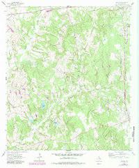
Margie and Flynn serve as the primary hubs in this corner of Leon County during the mid-1960s, a landscape defined by its network of winding creek branches and rural industry. The eastern edge is dominated by the parallel tracks of the Chicago Rock Island and Pacific and Fort Worth and Denver railroads, which facilitated the movement of goods through this wooded terrain. Local life is anchored by family landmarks and community centers like Old Bowlin Ch and Clear Creek Ch, while several Gravel Pits indicate the contemporary resource extraction shaping the land. The topography is intricately carved by waterways such as Buck Creek and Clear Creek, feeding into several named reservoirs including Chaney Lake and Ponderosa Lake. This survey provides a precise look at the local infrastructure before modern development, marking historical sites like Greer Cem and White Cem.
Find a feature on this map
28 named features on this map. Tap any name to fly to it.
Don’t see what you’re looking for? This feature index may not catch every label — zoom into the map to look around manually.
Map Details
Editions of this 1964 Margie Map
2 editions found
Other maps of this area

1925 · Marquez No. 1
USGS Topo · 1:48,000

1925 · Marquez No. 4
USGS Topo · 1:48,000

1927 · Marquez
USGS Topo · 1:62,500

1930 · Marquez
USGS Topo · 1:62,500

1954 · Waco
USGS Topo · 1:250,000

1955 · Waco
USGS Topo · 1:250,000

1956 · Jewett
USGS Topo · 1:62,500

1964 · Spring Seat
USGS Topo · 1:24,000
1964 · Normangee
USGS Topo · 1:24,000
1964 · Hilltop Lakes
USGS Topo · 1:24,000