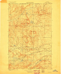
1913 Map of Marias Pass
USGS Topo · Published 1913About this map
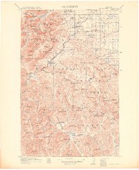
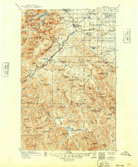
Marias Pass serves as the central focal point of this 1913 survey, marking the vital continental divide crossing for the Great Northern Railroad. The map documents a landscape in transition, with the newly established Glacier National Park occupying the northwest and the Blackfeet Indian Reservation to the northeast. Small railroad-aligned settlements like Glacier Park Sta, Midvale, Summit, and Fielding provide a sense of the early 20th-century transportation network that enabled access to this high-altitude region. Remote outposts such as the Three Forks Rangers Cabin and Rangers Cabin underscore the early administrative presence within the Lewis and Clark National Forest and Flathead National Forest. Significant water features, including Two Medicine Lake and Trick Falls, are meticulously recorded alongside topographical landmarks like Rising Wolf Mtn and Grizzly Mtn, illustrating the complex drainage patterns that define this part of the Northern Rockies.
Find a feature on this map
146 named features on this map. Tap any name to fly to it.
Don’t see what you’re looking for? This feature index may not catch every label — zoom into the map to look around manually.
Map Details
Editions of this 1913 Marias Pass Map
3 editions found
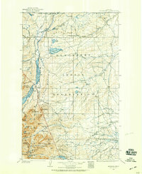
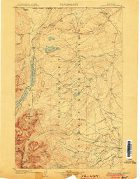
Other maps of this area
1901 · Browning
USGS Topo · 1:125,000
1903 · Browning
USGS Topo · 1:125,000

1903 · Saypo
USGS Topo · 1:125,000

1904 · Chief Mountain
USGS Topo · 1:125,000
1911 · Blackfoot
USGS Topo · 1:125,000

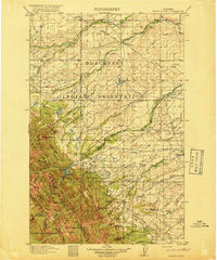
1913 · Marias Pass
USGS Topo · 1:125,000

1914 · Nyack
USGS Topo · 1:125,000

1914 · Heart Butte
USGS Topo · 1:125,000
1918 · Heart Butte
USGS Topo · 1:125,000

1936 · Silvertip
USGS Topo · 1:96,000