
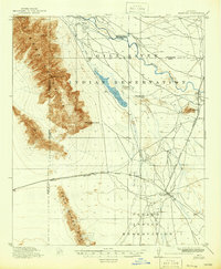
1915 Map of Maricopa
USGS Topo · Published 1915About this map
The Gila River Indian Reservation and Papago Indian Reservation dominate this desert landscape, where the confluence of the Gila River and Santa Cruz River once shaped regional movement. In this early twentieth-century survey, the shift from older desert outposts to rail-oriented towns is clearly visible. The map records the location of Maricopa Wells (Abandoned), a critical water stop on the old southern wagon road that was bypassed as transportation patterns evolved.
Find a feature on this map
21 named features on this map. Tap any name to fly to it.
Don’t see what you’re looking for? This feature index may not catch every label — zoom into the map to look around manually.
Map Details
Editions of this 1915 Maricopa Map
2 editions found
Other maps of this area

1912 · Phoenix
USGS Topo · 1:62,500

1913 · Mesa
USGS Topo · 1:62,500

1913 · Maricopa
USGS Topo · 1:62,500

1914 · Gila Butte
USGS Topo · 1:62,500

1914 · Phoenix
USGS Topo · 1:62,500

1915 · Mesa
USGS Topo · 1:62,500

1917 · Gila Butte
USGS Topo · 1:62,500

1922 · Casa Grande
USGS Topo · 1:62,500

1924 · Casa Grande
USGS Topo · 1:62,500

1946 · Antelope Peak
USGS Topo · 1:62,500