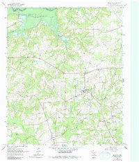
1965 Map of Marietta
USGS Topo · Published 1985About this map
The Sulphur River carves the boundary between Bowie and Cass counties, feeding into the northern reaches of Lake Texarkana. This landscape is defined by the heavy drainage of creeks like Bear Creek, Mill Creek, and Elliot Creek, which weave through the wooded hills of East Texas. Small rural settlements like Marietta, Nickleberry, and Cornett serve as local anchors, connected by a network of winding backroads and the St Louis Southwestern railroad corridor in the northwest. Genealogists will find significant detail in the distribution of family and community landmarks, including Bethlehem Ch and several burial grounds such as Creekmore Cem and Dalton Cem. The presence of the Pipeline cutting across the southern terrain highlights the region's mid-century infrastructure alongside its long-standing agricultural and timber character.
Find a feature on this map
30 named features on this map. Tap any name to fly to it.
Don’t see what you’re looking for? This feature index may not catch every label — zoom into the map to look around manually.
Map Details
Editions of this 1965 Marietta Map
2 editions found
Other maps of this area

1909 · New Boston
USGS Topo · 1:62,500

1910 · Linden
USGS Topo · 1:62,500

1914 · Daingerfield
USGS Topo · 1:62,500

1930 · Bassett
USGS Topo · 1:62,500

1953 · Texarkana
USGS Topo · 1:250,000

1955 · Corley
USGS Topo · 1:24,000

1955 · New Boston
USGS Topo · 1:62,500

1956 · Texarkana
USGS Topo · 1:250,000

1964 · Daingerfield
USGS Topo · 1:24,000

1965 · Marietta
USGS Topo · 1:24,000