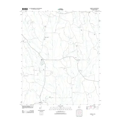
2012 Map of Marietta
USGS Topo · Published 2012About this map
The town of Marietta anchors the southern portion of this landscape, situated near the headwaters of Hurricane Cr and Granny Cr. This Prentiss County territory is defined by a dense network of cemeteries that speak to long-standing rural communities, including Marietta Cem, East Marietta Cem, and the more remote Mount Nebo Cem in the northeast. The geography is characterized by numerous small drainage systems, such as Big Brown Cr and Sapling Cr, which influence the winding paths of the local county road system.
Find a feature on this map
99 named features on this map. Tap any name to fly to it.
Don’t see what you’re looking for? This feature index may not catch every label — zoom into the map to look around manually.
Map Details
Editions of this 2012 Marietta Map
This is the sole edition of this map. No revisions or reprints were ever made.
Other maps of this area

1921 · Booneville
USGS Topo · 1:48,000

1921 · Tupelo
USGS Topo · 1:48,000

1922 · Booneville
USGS Topo · 1:62,500

1923 · Tupelo
USGS Topo · 1:62,500

1935 · Holcut
USGS Topo · 1:24,000

1950 · Paden
USGS Topo · 1:24,000

1950 · Altitude
USGS Topo · 1:24,000

1956 · Tupelo
USGS Topo · 1:250,000

1958 · Tupelo
USGS Topo · 1:250,000
1965 · Paden SE
USGS Topo · 1:24,000