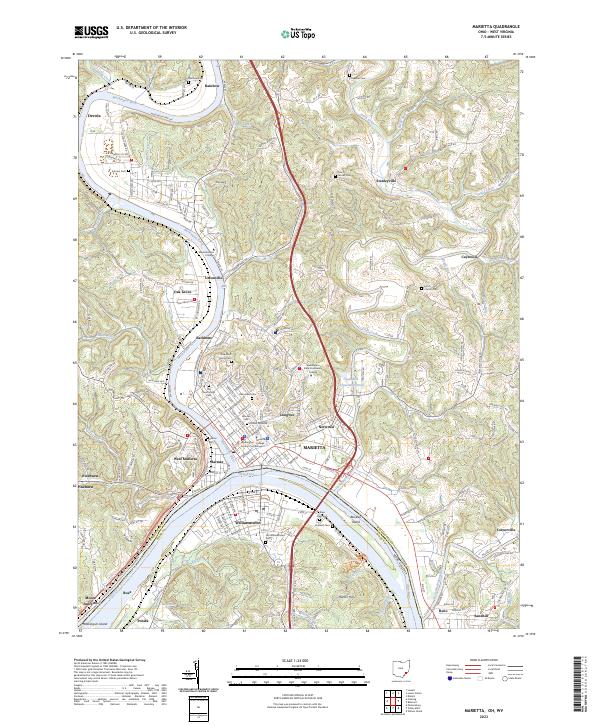
2023 Map of Marietta
USGS Topo · Published 2023About this map
The confluence of the Muskingum River and the Ohio River anchors this detailed study of Marietta and its surrounding communities. The landscape is defined by its deep historical layers, featuring the Washington County Courthouse and the ancient earthworks of the Conus Mound. Educational institutions like Marietta College and Washington State Community College sit alongside a high density of local heritage sites, including the Mound Cem and Harmar Cem.
Find a feature on this map
129 named features on this map. Tap any name to fly to it.
Don’t see what you’re looking for? This feature index may not catch every label — zoom into the map to look around manually.
Map Details
Editions of this 2023 Marietta Map
This is the sole edition of this map. No revisions or reprints were ever made.
Other maps of this area

1902 · Parkersburg
USGS Topo · 1:62,500

1903 · Macksburg
USGS Topo · 1:62,500

1904 · Parkersburg
USGS Topo · 1:62,500

1904 · Marietta
USGS Topo · 1:62,500

1905 · Macksburg
USGS Topo · 1:62,500

1909 · Caldwell
USGS Topo · 1:62,500

1912 · Caldwell
USGS Topo · 1:62,500

1924 · Marietta
USGS Topo · 1:62,500

1927 · Marietta
USGS Topo · 1:62,500

1949 · Clarksburg
USGS Topo · 1:250,000