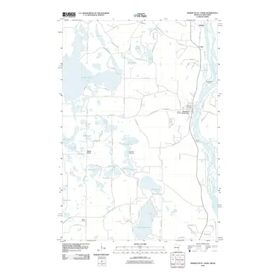
2010 Map of Marine on St. Croix
USGS Topo · Published 2010About this map
Marine on Saint Croix serves as the focal point of this river-centered landscape, situated along the western banks of the Saint Croix River. The area is characterized by a high density of glacial lakes and wetlands, including the expansive Big Marine Lake and the smaller Square Lake. The settlement pattern follows the river and the primary north-south corridors, with communities like Copas and Otisville appearing to the north.
Find a feature on this map
84 named features on this map. Tap any name to fly to it.
Don’t see what you’re looking for? This feature index may not catch every label — zoom into the map to look around manually.
Map Details
Editions of this 2010 Marine on St. Croix Map
This is the sole edition of this map. No revisions or reprints were ever made.
Other maps of this area

1900 · St Croix Dalles
USGS Topo · 1:62,500

1901 · St Croix Dalles
USGS Topo · 1:62,500

1948 · New Richmond
USGS Topo · 1:62,500

1948 · Stillwater
USGS Topo · 1:62,500

1949 · New Richmond
USGS Topo · 1:62,500

1949 · Stillwater
USGS Topo · 1:62,500

1951 · White Bear Lake East
USGS Topo · 1:24,000

1951 · Stillwater
USGS Topo · 1:24,000

1953 · Stillwater
USGS Topo · 1:250,000

1954 · Hugo
USGS Topo · 1:24,000