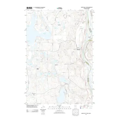
2013 Map of Marine on St. Croix
USGS Topo · Published 2013About this map
The Saint Croix River forms the eastern boundary of this landscape, carving a deep valley that separates Washington County, Minnesota, from the Wisconsin shore. The river-adjacent settlements of Marine on Saint Croix, Copas, and Otisville are linked by the Saint Croix Trail, while the interior transitions into a dense concentration of glacial lakes. Notable water bodies including Big Marine Lake, Square Lake, and Terrapin Lake define the local topography, influencing the winding path of rural roads like Mayberry Trail. Local heritage is anchored by sites such as Elim Cem in Scandia and Oakland Cem, alongside recreational landmarks like Camp Kiwanis and the Amherst H Wilder Day Camp Area. The presence of the Keller Airport near Maple Island reflects the modern utility of this diverse lakeside and riverine region.
Find a feature on this map
96 named features on this map. Tap any name to fly to it.
Don’t see what you’re looking for? This feature index may not catch every label — zoom into the map to look around manually.
Map Details
Editions of this 2013 Marine on St. Croix Map
This is the sole edition of this map. No revisions or reprints were ever made.
Other maps of this area

1900 · St Croix Dalles
USGS Topo · 1:62,500

1901 · St Croix Dalles
USGS Topo · 1:62,500

1948 · New Richmond
USGS Topo · 1:62,500

1948 · Stillwater
USGS Topo · 1:62,500

1949 · New Richmond
USGS Topo · 1:62,500

1949 · Stillwater
USGS Topo · 1:62,500

1951 · White Bear Lake East
USGS Topo · 1:24,000

1951 · Stillwater
USGS Topo · 1:24,000

1953 · Stillwater
USGS Topo · 1:250,000

1954 · Hugo
USGS Topo · 1:24,000