2022 Map of Marine on St. Croix
USGS Topo · Published 2022About this map
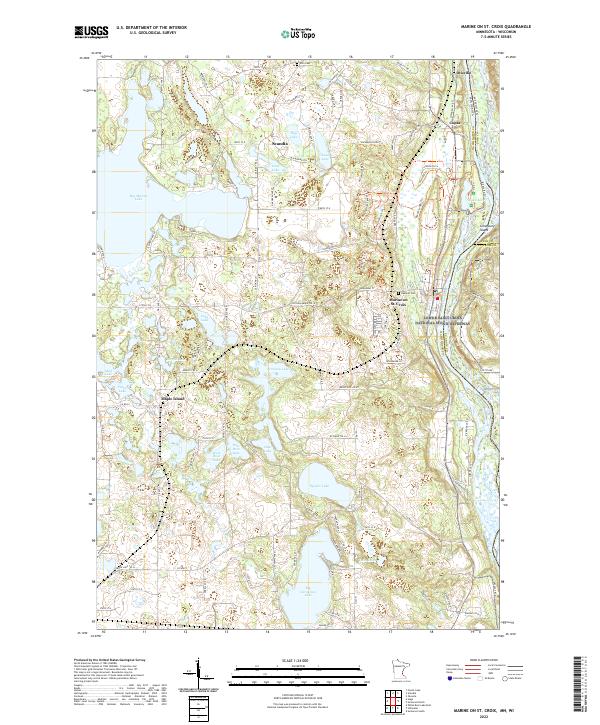
The Saint Croix Wild and Scenic River forms the eastern boundary of this landscape, carving a deep valley that separates Minnesota from Wisconsin. The historic village of Marine on St. Croix sits on the bluff above the river, a community defined by its early logging roots and proximity to the Lower Saint Croix National Scenic Riverway. Moving west from the river, the terrain is dominated by a dense network of glacial lakes including Big Marine Lake, Long Lake, and Square Lake, which have long shaped the recreation and settlement patterns of Washington County. Smaller communities like Scandia, Copas, and Otisville are linked by rural routes such as Old Marine Trl N, while local history is anchored at sites like Elim Cem and Oakland Cem. This survey illustrates the contrast between the protected river corridor and the inland lake country, where trails such as Prairie Overlook Trl and Hardwood Hills Trl offer access to the varied topography.
Find a feature on this map
117 named features on this map. Tap any name to fly to it.
Don’t see what you’re looking for? This feature index may not catch every label — zoom into the map to look around manually.
Map Details
Editions of this 2022 Marine on St. Croix Map
This is the sole edition of this map. No revisions or reprints were ever made.
Historical Maps of Marine on Saint Croix Through Time
1 maps found