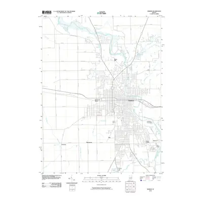
2010 Map of Marion
USGS Topo · Published 2010About this map
The Mississinewa River winds through the heart of Marion, Indiana, anchoring a landscape where historical burial grounds and industrial drainage patterns intersect. Significant for genealogists, the area includes the Marion National Cemetery and the Independent Order of Odd Fellows Cemetery on the eastern edge of the city. The township grid is heavily modified by an extensive network of man-made waterways like Steelman Ditch, Lomax Ditch, and Hailies Prairie Ditch, reflecting the region's agricultural engineering. Residential developments such as Shady Hills and Westwood Square contrast with smaller, named localities like Michaelsville and Home Corner. To the south, the Glendale Lake Dam regulates Glendale Lake, while the Frances Slocum Trl traces the river's northern banks, preserving the memory of the area's early frontier history.
Find a feature on this map
50 named features on this map. Tap any name to fly to it.
Don’t see what you’re looking for? This feature index may not catch every label — zoom into the map to look around manually.
Map Details
Editions of this 2010 Marion Map
This is the sole edition of this map. No revisions or reprints were ever made.
Other maps of this area

1950 · Mount Etna
USGS Topo · 1:24,000

1951 · Mount Etna
USGS Topo · 1:24,000

1953 · La Fontaine
USGS Topo · 1:24,000

1953 · Somerset
USGS Topo · 1:24,000

1953 · Muncie
USGS Topo · 1:250,000

1956 · Muncie
USGS Topo · 1:250,000

1960 · Point Isabel
USGS Topo · 1:24,000

1960 · Fairmount
USGS Topo · 1:24,000

1960 · Gas City
USGS Topo · 1:24,000

1961 · Marion
USGS Topo · 1:24,000