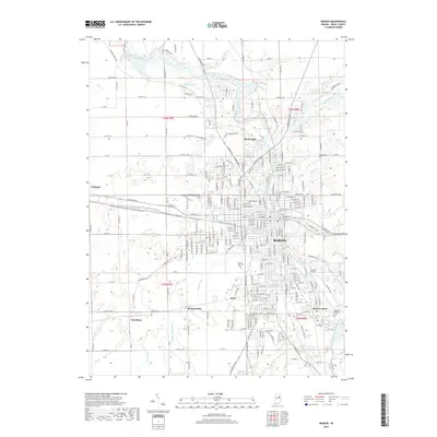
2019 Map of Marion
USGS Topo · Published 2019About this map
The Mississinewa River winds through the heart of Grant County, anchoring the urban development of Marion and its surrounding suburbs. This modern survey illustrates the dense residential and industrial grid of the city, transitioning into an intricate system of agricultural drainage ditches such as Steelman Ditch and Hailes Prairie Ditch in the outlying rural townships. The map documents several distinct neighborhood clusters and small settlements, including Michaelsville, Roseburg, and Home Corner, which reflect the historical expansion of the community beyond the central business district. For researchers and genealogists, the map provides precise locations for significant local landmarks like Grant Memorial Park and the Marion National Cem, alongside transportation corridors such as the Marion to Gas City rail line and the historic Frances Slocum Trl.
Find a feature on this map
239 named features on this map. Tap any name to fly to it.
Don’t see what you’re looking for? This feature index may not catch every label — zoom into the map to look around manually.
Map Details
Editions of this 2019 Marion Map
This is the sole edition of this map. No revisions or reprints were ever made.
Other maps of this area

1950 · Mount Etna
USGS Topo · 1:24,000

1951 · Mount Etna
USGS Topo · 1:24,000

1953 · La Fontaine
USGS Topo · 1:24,000

1953 · Somerset
USGS Topo · 1:24,000

1953 · Muncie
USGS Topo · 1:250,000

1956 · Muncie
USGS Topo · 1:250,000

1960 · Point Isabel
USGS Topo · 1:24,000

1960 · Fairmount
USGS Topo · 1:24,000

1960 · Gas City
USGS Topo · 1:24,000

1961 · Marion
USGS Topo · 1:24,000