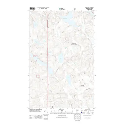
2013 Map of Marion Lake
USGS Topo · Published 2013About this map
Superior National Forest encompasses this section of Saint Louis County, where a dense network of glacial lakes and rivers defines the landscape. The hydrography of the region is centered on significant bodies of water such as Marion Lake and Moose Lake, connected by drainage systems including the Moose River and Johnson River. This area is characterized by its absence of permanent settlements, instead featuring a complex web of seasonal access routes and fire roads managed by the Forest Service. Forest roads such as Forest Rte 493 and Forest Rd 203 provide the primary infrastructure for navigating the backcountry between Amundsen Lake and Johnson Lake. The terrain is marked by numerous smaller water features, such as Pot Hole Lake, Bluebird Lake, and Spring Lake, reflecting the post-glacial topography of northern Minnesota as it was documented in the early twenty-first century.
Find a feature on this map
21 named features on this map. Tap any name to fly to it.
Don’t see what you’re looking for? This feature index may not catch every label — zoom into the map to look around manually.
Map Details
Editions of this 2013 Marion Lake Map
This is the sole edition of this map. No revisions or reprints were ever made.
Other maps of this area

1954 · International Falls
USGS Topo · 1:250,000

1957 · International Falls
USGS Topo · 1:250,000

1958 · International Falls
USGS Topo · 1:250,000

1967 · Namakan Island
USGS Topo · 1:24,000

1967 · Kabustasa Lake
USGS Topo · 1:24,000

1967 · Marion Lake
USGS Topo · 1:24,000

1967 · Hale Bay
USGS Topo · 1:24,000

1967 · Elephant Lake
USGS Topo · 1:24,000

1967 · Johnson Lake
USGS Topo · 1:24,000

1968 · Ash River SE
USGS Topo · 1:24,000