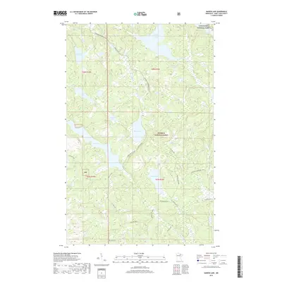
2019 Map of Marion Lake
USGS Topo · Published 2019About this map
Voyageurs National Park and the Superior National Forest meet in this Northwoods landscape, where water defines every boundary. The map captures a complex network of glacial lakes and waterways, from the broad reach of Elephant Lake in the southeast to the secluded Amundsen Lake in the northwest. This area serves as a significant recreational corridor, evidenced by the extensive Voyageur Snowmobile Trail that snakes across the northern sections and specialized routes like the Marion ATV Trail near Marion Lake. The presence of numerous unnamed wetlands and small basins like Pot Hole Lake reflects the region's characteristic post-glacial drainage pattern. Navigability and access are dictated by the Moose River and Johnson River, which link these interior basins to the larger wilderness systems beyond the quadrangle's edges.
Find a feature on this map
33 named features on this map. Tap any name to fly to it.
Don’t see what you’re looking for? This feature index may not catch every label — zoom into the map to look around manually.
Map Details
Editions of this 2019 Marion Lake Map
This is the sole edition of this map. No revisions or reprints were ever made.
Other maps of this area

1954 · International Falls
USGS Topo · 1:250,000

1957 · International Falls
USGS Topo · 1:250,000

1958 · International Falls
USGS Topo · 1:250,000

1967 · Namakan Island
USGS Topo · 1:24,000

1967 · Kabustasa Lake
USGS Topo · 1:24,000

1967 · Marion Lake
USGS Topo · 1:24,000

1967 · Hale Bay
USGS Topo · 1:24,000

1967 · Elephant Lake
USGS Topo · 1:24,000

1967 · Johnson Lake
USGS Topo · 1:24,000

1968 · Ash River SE
USGS Topo · 1:24,000