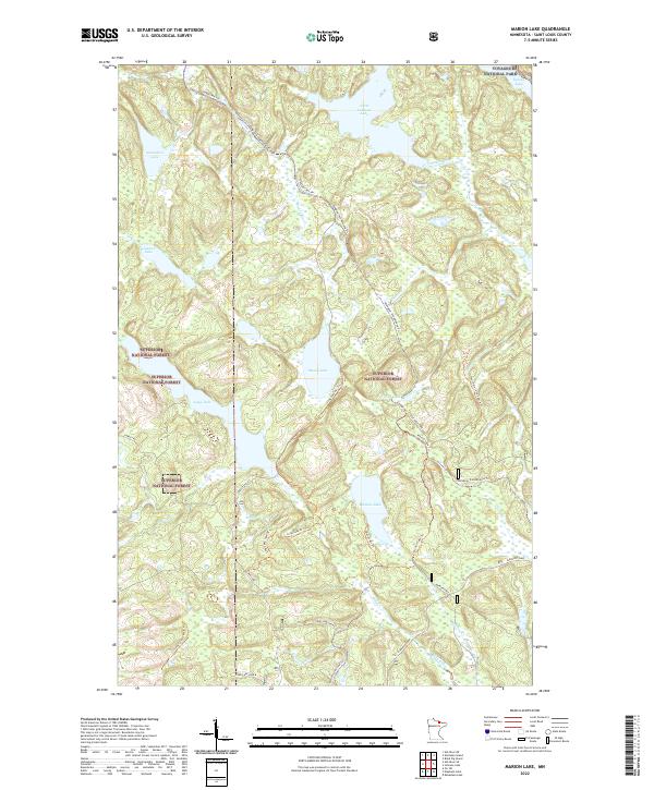
2022 Map of Marion Lake
USGS Topo · Published 2022About this map
Voyageurs National Park and Superior National Forest meet in this wilderness corner of Northern Minnesota, where the landscape is defined by a dense network of lakes and watercourses. Central to this survey are Moose Lake and Marion Lake, connected by intricate drainage systems including Moose River and Elm Creek. Unlike the agricultural or industrial corridors found elsewhere, this region's infrastructure is built for recreation and conservation.
Find a feature on this map
34 named features on this map. Tap any name to fly to it.
Don’t see what you’re looking for? This feature index may not catch every label — zoom into the map to look around manually.
Map Details
Editions of this 2022 Marion Lake Map
This is the sole edition of this map. No revisions or reprints were ever made.
Other maps of this area

1954 · International Falls
USGS Topo · 1:250,000

1957 · International Falls
USGS Topo · 1:250,000

1958 · International Falls
USGS Topo · 1:250,000

1967 · Namakan Island
USGS Topo · 1:24,000

1967 · Kabustasa Lake
USGS Topo · 1:24,000

1967 · Marion Lake
USGS Topo · 1:24,000

1967 · Hale Bay
USGS Topo · 1:24,000

1967 · Elephant Lake
USGS Topo · 1:24,000

1967 · Johnson Lake
USGS Topo · 1:24,000

1968 · Ash River SE
USGS Topo · 1:24,000