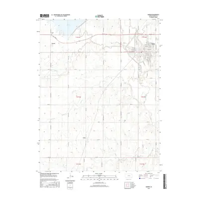
2015 Map of Marion
USGS Topo · Published 2015About this map
Marion Reservoir dominates the northwestern landscape of this Kansas prairie region, where the N Cottonwood River feeds into the expansive water body. The city of Marion serves as the primary hub in the northeast, positioned where the Cottonwood River and Mud Cr converge. This 2015 data reflects a terrain deeply shaped by water management and a rigid grid of rural section roads, including Nighthawk Rd and Sunflower Rd, which connect the outlying settlements of Canada and Aulne. Genealogists may find value in the location of the Canada Cem near the reservoir or the Claney Cem further south. The land is defined by drainage patterns from smaller waterways like Spring Br and Catlin Cr, which cut through the agricultural sections of Township 19, 20, and 21 South.
Find a feature on this map
64 named features on this map. Tap any name to fly to it.
Don’t see what you’re looking for? This feature index may not catch every label — zoom into the map to look around manually.
Map Details
Editions of this 2015 Marion Map
This is the sole edition of this map. No revisions or reprints were ever made.
Other maps of this area

1889 · Newton
USGS Topo · 1:125,000

1894 · Newton
USGS Topo · 1:125,000

1898 · Cottonwood Falls
USGS Topo · 1:125,000

1955 · Hutchinson
USGS Topo · 1:250,000

1957 · Peabody NW
USGS Topo · 1:24,000

1957 · Florence
USGS Topo · 1:24,000

1957 · Lincolnville SW
USGS Topo · 1:24,000

1957 · Peabody
USGS Topo · 1:24,000

1959 · Hutchinson
USGS Topo · 1:250,000

1971 · Durham
USGS Topo · 1:24,000