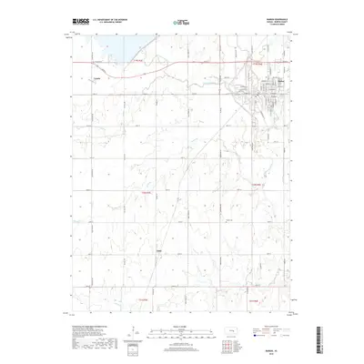
2018 Map of Marion
USGS Topo · Published 2018About this map
Marion serves as the primary hub of this Kansas landscape, situated where the Cottonwood River and Mud Cr converge. The town's grid is dense with named streets, including W Main St and W Santa Fe St, reflecting a well-established community center. To the west, the rural character is defined by the small settlements of Canada and Aulne, which appear as quiet crossroads within the expansive section-line road network. The drainage patterns of the N Cottonwood River and S Cottonwood River dictate the local topography, carving shallow valleys through the central plains. Genealogists will find the locations of Canada Cem near the northern border and Claney Cem further south, providing essential markers for family history research in Marion County.
Find a feature on this map
60 named features on this map. Tap any name to fly to it.
Don’t see what you’re looking for? This feature index may not catch every label — zoom into the map to look around manually.
Map Details
Editions of this 2018 Marion Map
This is the sole edition of this map. No revisions or reprints were ever made.
Other maps of this area

1889 · Newton
USGS Topo · 1:125,000

1894 · Newton
USGS Topo · 1:125,000

1898 · Cottonwood Falls
USGS Topo · 1:125,000

1955 · Hutchinson
USGS Topo · 1:250,000

1957 · Peabody NW
USGS Topo · 1:24,000

1957 · Florence
USGS Topo · 1:24,000

1957 · Lincolnville SW
USGS Topo · 1:24,000

1957 · Peabody
USGS Topo · 1:24,000

1959 · Hutchinson
USGS Topo · 1:250,000

1971 · Durham
USGS Topo · 1:24,000