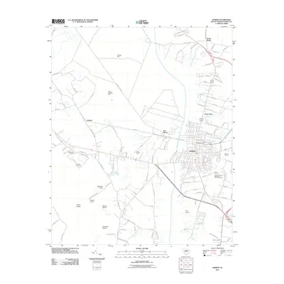
2011 Map of Marion
USGS Topo · Published 2011About this map
Marion, South Carolina, is established here as a developed regional hub, characterized by a dense grid of residential and commercial streets that radiate toward the Marion Post Office and outlying settlements. The landscape transitions from the urban core of Marion to the satellite communities of West Marion and Laughlin, revealing a pattern of expansion along historic road corridors. To the east, Rose Hill Cemetery and Durant Cemetery provide significant genealogical touchpoints for local families.
Find a feature on this map
113 named features on this map. Tap any name to fly to it.
Don’t see what you’re looking for? This feature index may not catch every label — zoom into the map to look around manually.
Map Details
Editions of this 2011 Marion Map
This is the sole edition of this map. No revisions or reprints were ever made.
Other maps of this area

1940 · Florence East
USGS Topo · 1:62,500

1943 · Gum Swamp
USGS Topo · 1:62,500

1945 · Florence East
USGS Topo · 1:62,500

1946 · Mullins
USGS Topo · 1:24,000

1947 · Friendship
USGS Topo · 1:24,000

1947 · Marion
USGS Topo · 1:24,000

1947 · Centenary
USGS Topo · 1:24,000

1947 · Mullins
USGS Topo · 1:24,000

1953 · Florence
USGS Topo · 1:250,000

1954 · Florence
USGS Topo · 1:250,000