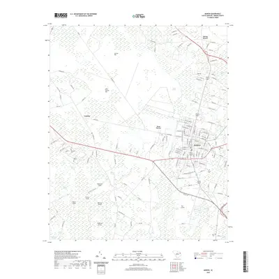
2020 Map of Marion
USGS Topo · Published 2020About this map
Marion anchors this section of South Carolina, where the traditional grid of the county seat meets a landscape defined by expansive Carolina Bays and low-lying wetlands. The geography is dominated by distinctive oval depressions such as Ellerbe Bay, Catfish Bay, and Gum Swamp Bay, which shape the local drainage and road patterns. To the west of the city, West Marion and Laughlin serve as established nodes along the primary transit corridors. The area's history is preserved in its numerous burial grounds, including Springville Cem, Spencer Cem, and Rose Hill Cem, which are scattered among the ridges and bay edges. In the southern reaches, the land breaks into complex island chains like the Singletary Islands and Hickory Island within a network of swamps and streams, including the Catfish Canal and Millrace Stream. This survey captures the intersection of rural agricultural tracts and the town's steady suburban expansion toward the wetlands.
Find a feature on this map
137 named features on this map. Tap any name to fly to it.
Don’t see what you’re looking for? This feature index may not catch every label — zoom into the map to look around manually.
Map Details
Editions of this 2020 Marion Map
This is the sole edition of this map. No revisions or reprints were ever made.
Other maps of this area

1940 · Florence East
USGS Topo · 1:62,500

1943 · Gum Swamp
USGS Topo · 1:62,500

1945 · Florence East
USGS Topo · 1:62,500

1946 · Mullins
USGS Topo · 1:24,000

1947 · Friendship
USGS Topo · 1:24,000

1947 · Marion
USGS Topo · 1:24,000

1947 · Centenary
USGS Topo · 1:24,000

1947 · Mullins
USGS Topo · 1:24,000

1953 · Florence
USGS Topo · 1:250,000

1954 · Florence
USGS Topo · 1:250,000