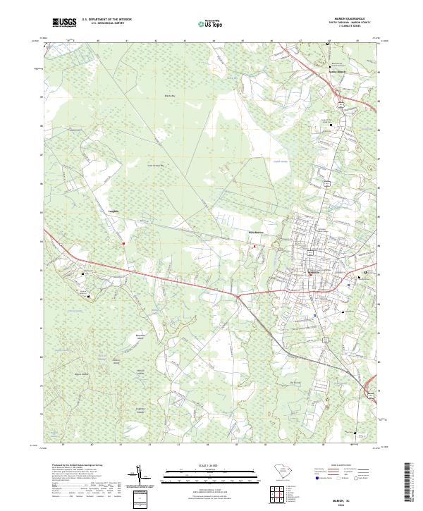
2024 Map of Marion
USGS Topo · Published 2024About this map
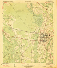
Marion, South Carolina, serves as the central hub of this modern survey, which details the town's grid and surrounding wetland landscape. The historic Marion County Courthouse stands at the center of a community ringed by significant water features including Catfish Swamp and the Catfish Canal. The geography is defined by a series of distinct bays and swamp systems, such as Ellerbe Bay and Gum Swamp Bay, which isolate higher grounds like Blackwell Island and the Singletary Islands. Small rural settlements like Spring Branch and Laughlin appear on the outskirts, connected by a network of local roads and the Bus 501 line.
Find a feature on this map
143 named features on this map. Tap any name to fly to it.
Don’t see what you’re looking for? This feature index may not catch every label — zoom into the map to look around manually.
Map Details
Editions of this 2024 Marion Map
This is the sole edition of this map. No revisions or reprints were ever made.